(1961 - 1990)
Tornado Dynamics
A rotating updraft is a key to the development of a supercell, and eventually a tornado. There are many ideas about how this rotation begins. One way a column of air can begin to rotate is from wind shear – when winds at two different levels above the ground blow at different speeds or in different directions.
An example of wind shear that can eventually create a tornado is when winds at ground level, often slowed down by friction with the earth's surface, come from the southwest at 5 mph. But higher up, at 5000 feet above the same location, the winds are blowing from the southeast at 25 mph. An invisible "tube" of air begins to rotate horizontally. Rising air within the thunderstorm tilts the rotating air from horizontal to vertical – now the area of rotation extends through much of the storm. Once the updraft is rotating and being fed by warm, moist air flowing in at ground level, a tornado can form.
The schematic below illustrates wind entering the low and middle levels of the storm (green and purple arrows) from different directions which can cause rotation. The rear flank downdraft can tilt and stretch horizontal tubes of rotating air and form tornadoes.
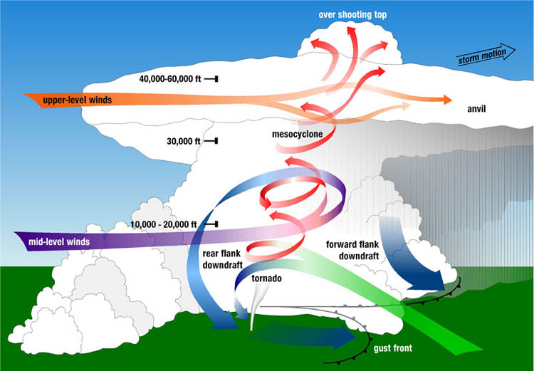
Supercell Thunderstorm Schematic (courtesy of NSSL)